An automated flight control system for drone swarms has been developed
7/19/21
Creating new procedures that improve mass drone traffic is the purpose of LABYRINTH, a European research project coordinated by the Universidad Carlos III de Madrid (UC3M) with the participation of 13 international organisations within the R&D&I, transport, emergency, and auxiliary services fields. Researchers hope to use these drone swarm applications to improve civil road, train, sea, and air transport, making it safer, more efficient, and more sustainable.
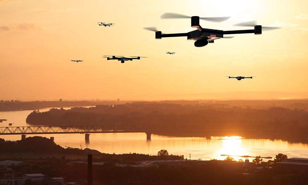
“The project’s main objective is to integrate a certain degree of automation, so that an operator can control a small fleet of up to 10 drones from a single ground station,” says Luis E. Moreno, LABYRINTH’s coordinator and researcher at the UC3M’s Robotics Lab. “The idea is that the operator indicates the mission to be undertaken (for example, monitoring traffic in a particular area) and the system automatically converts this mission into a set of routes that each drone has to follow, automatically calculating alternative routes when necessary,” he explains. In addition to planning and controlling routes, two other areas of technology are being subject to work: communication using 5G networks (so that drones are connected at all times) and the computer security behind the entire system.
Researchers have already developed an initial strategy for planning routes and preventing collisions for drone swarms in three-dimensional environments, in an article published in the Sensors journal. In order to do this, they first designed a 3D model that simulates an urban environment, where they established take-off and landing zones. Then they tested a planning algorithm that was responsible for calculating optimal, fluid routes for a set of drones. Finally, they implemented different measures (flights at different altitudes, distance control, etc.) to obtain a strategy for avoiding possible collisions.
Researchers at the LABYRINTH project are developing these technologies within the framework of U-Space, a new European drone air traffic management system led by the SESAR (Single European Sky ATM Research) initiative. This new framework is designed to integrate low-level drone operations, below 120 metres (400 feet), safely and efficiently into European airspace.
“Air controllers use ATM (Air Traffic Management) to safely manage the traffic of commercial aircraft. Similarly, developing an Unmanned Traffic Management (UTM) system that allows drones to share airspace with other drones and aircraft is imperative,” explains Francisco Valera, another scientist taking part in this project and a member of NETCOM (Networks and Communications Services) at the UC3M. This research group, along with Telefonica I+D and the IMDEA Networks Institute, recently presented an experimental study about the use of mobile technologies in drone networks in the Sensors journal.
Possible applications
Drones can be useful in different applications, such as delivering and transporting goods, monitoring in different environments, or accessing places that are difficult to reach in emergency situations, for example. However, there have been concerns about the safety of these flights until now, which have limited their use and it is often illegal to use drones in certain public areas. It is estimated that by 2035 there will be approximately 400,000 drones flying within Europe, so the biggest challenge in this regard will be safely managing drone traffic in cities and other areas with high levels of congestion.
The foreseen applications within the LABYRINTH project framework concern different environments in Spain. For example, work is being undertaken with the Directorate-General for Traffic (DGT, in its Spanish acronym) to use drones to improve road transport, analysing aspects such as speed control, measuring the distance between vehicles, identifying license plates, and following up on and providing support in the event of accidents. Another initiative with the National Institute of Aerospace Technology (INTA, in its Spanish acronym) is intending to use drones at airports to control unauthorised access, inspect tracks, or use them as a deterrent against birds. In the case of managing emergencies at large gatherings (such as at concerts or sporting events), a collaboration with the SAMUR-Protección Civil of Madrid is in place for pre-emergency surveillance operations (identifying exit routes, medical care points or danger zones, calculating street capacity) and assistance with medical operations (faster routes to incidents, transporting specialised material or medicine).
LABYRINTH (Ensuring drone traffic control and safety) is a project funded by the European Union’s H2020 Programme (GA 861696) that is being coordinated by the UC3M. This R&D&I consortium is made up of 13 research centres and industrial partners from 5 countries (Germany, Austria, Belgium, Spain, and Italy). The Spanish institutions that are participating, along with the UC3M, are the Directorate-General for Traffic (DGT), the National Institute of Aerospace Technology (INTA), the SAMUR-ProtecciónCivil of Madrid and the companies Expace on Board Systems, Inncome, PONS Seguridad Vial and Telefonica I+D. The Western Ligurian Sea Port Authority (Italy), the German Aerospace Center (DLR), the German Institute for Standardization (DIN), the Austrian Institute of Technology (AIT), and the European Organisation for the Safety of Air Navigation (EUROCONTROL) are also taking part in the project.
More information: Website for the LABYRINTH project
Bibliography:
Blanca López, Javier Muñoz, Fernando Quevedo, Concepción A. Monje, Santiago Garrido, Luis E. Moreno (2021). Path Planning and Collision Risk Management Strategy for Multi-UAV Systems in 3D Environments. Sensors. Key: A Volume: 21, N. 4414 (2021), p. 1-21. DOI: https://doi.org/10.3390/s21134414
VictorSanchez-Aguero, Luis F. Gonzalez, Francisco Valera, Ivan Vidal y Rafael A. López da Silva (2021). Cellular and Virtualization Technologies for UAVs: An Experimental Perspective. Sensors. Volume 21(9), N. 3093; DOI: https://doi.org/10.3390/s21093093
-------------